Intelligence delivered to the front lines

The Open Data Program gets near real-time satellite imagery and other spatial intelligence directly into the hands of first responders to improve the effectiveness and speed of their work.

Request an Activation
10_flooded homes and fields_ostrava_czech republic_17sept2024_ge1.jpg
AdobeStock_1579673016.jpeg
ODP Partners.png
Permissive Licensing

Enabling rapid response

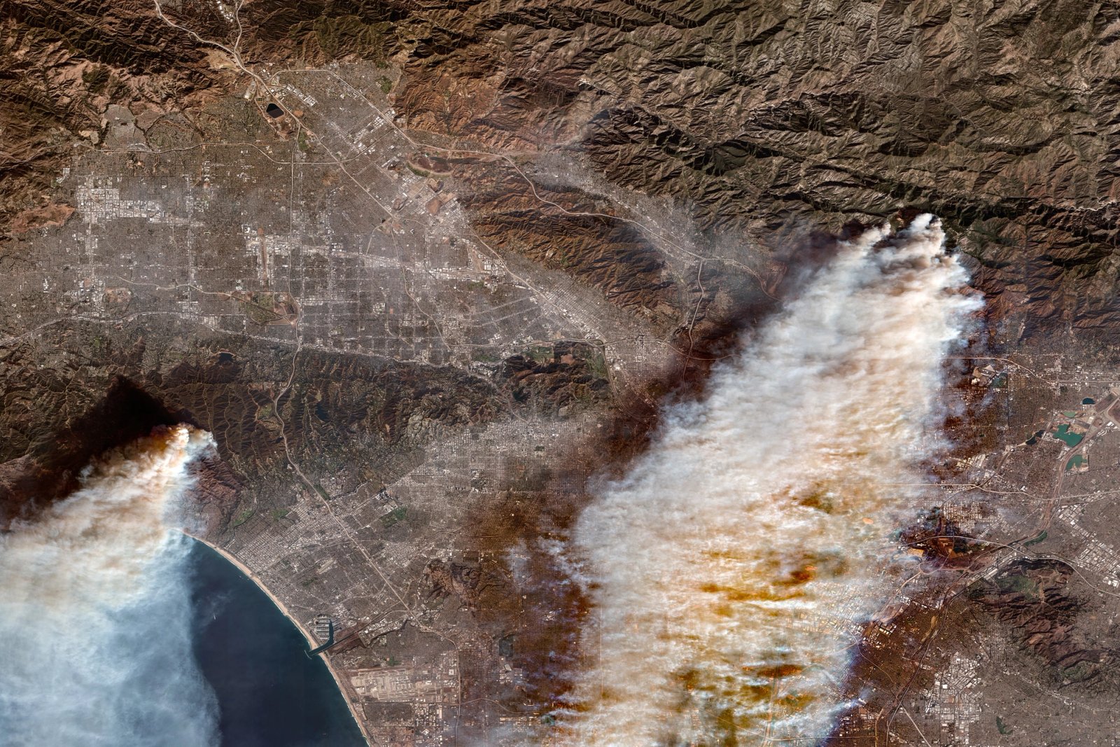
Through the Open Data Program, Vantor releases before and after satellite imagery into the public domain under a Creative Commons 4.0 license, which allows for its rapid use and easy integration with existing humanitarian response technologies.

Our Protocol

Built around simple activation criteria

We activate our Open Data Program when:

  • The event is a sudden onset disaster.
  • It is categorized as a major event based on geographic scope, humanitarian impact, and expectation of need.
  • A Vantor FirstLook event service has been activated.

To learn more, read our full Activation Protocol guidelines here.

Open Data Program Partners

Supporting teams on the front lines

We partner with leading nonprofits around the world to ensure they get the intelligence they need on an actionable timeline. They provide feedback to help us improve the program, share the data with other teams on the ground, and request activations for events.

Access our latest activations

Browse recent Open Data Program releases on our Discover portal.

Explore